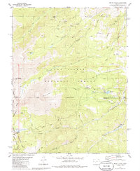
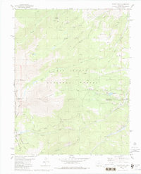
1980 Map of Mount Ouray
USGS Topo · Published 1986About this map
Continental Divide winds through this high-altitude landscape of Chaffee and Saguache counties, anchoring a terrain defined by massive peaks and narrow drainage basins. The survey captures the transition from the San Isabel National Forest to the Gunnison National Forest, punctuated by the 13,000-foot heights of Mount Ouray and Chipeta Mountain. Deep in the backcountry, the Cinderella South Mine and various Prospects indicate the region's mineral interests, while the Shirley (Site) near Poncha Creek marks a location where earlier settlement once thrived. The drainage network is dense, with Green Creek, Browns Creek, and Cochetopa Creek carving through the granite. High-country water features like Pass Creek Lake, O'Haver Lake, and Silver Creek Lakes provide focal points for the surrounding Pack Trail and Jeep Trail networks that cross the divide at Marshall Pass.
Find a feature on this map
40 named features on this map. Tap any name to fly to it.
Don’t see what you’re looking for? This feature index may not catch every label — zoom into the map to look around manually.
Map Details
Editions of this 1980 Mount Ouray Map
5 editions found
Other maps of this area

1940 · Garfield
USGS Topo · 1:62,500

1945 · Garfield
USGS Topo · 1:62,500

1956 · Poncha Springs
USGS Topo · 1:62,500

1956 · Montrose
USGS Topo · 1:250,000

1959 · Montrose
USGS Topo · 1:250,000

1959 · Bonanza
USGS Topo · 1:62,500

1960 · Montrose
USGS Topo · 1:250,000

1967 · Chester
USGS Topo · 1:24,000

1967 · Pahlone Peak
USGS Topo · 1:24,000

1968 · Montrose
USGS Topo · 1:250,000