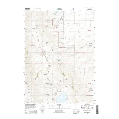
2014 Map of Mount Pisgah
USGS Topo · Published 2014About this map
The Wellsville Mountains dominate this landscape, rising sharply between the valley floors of Brigham City and Wellsville. This high-altitude terrain is defined by complex drainage systems and mountain passes, notably Sardine Summit which serves as a critical passage for US Hwy 89 91. The map reveals a land utilized for both resources and recreation, with the Cache National Forest covering much of the central peaks and canyons like Silver Mine Hollow hinting at historical mining activity.
Find a feature on this map
104 named features on this map. Tap any name to fly to it.
Don’t see what you’re looking for? This feature index may not catch every label — zoom into the map to look around manually.
Map Details
Editions of this 2014 Mount Pisgah Map
This is the sole edition of this map. No revisions or reprints were ever made.
Other maps of this area

1914 · Logan
USGS Topo · 1:125,000

1916 · Logan
USGS Topo · 1:125,000

1954 · Ogden
USGS Topo · 1:250,000

1954 · Brigham City
USGS Topo · 1:250,000

1955 · Paradise
USGS Topo · 1:24,000

1955 · Mantua
USGS Topo · 1:24,000

1955 · James Peak
USGS Topo · 1:24,000

1955 · Willard
USGS Topo · 1:24,000

1955 · Mount Pisgah
USGS Topo · 1:24,000

1955 · Brigham City
USGS Topo · 1:24,000