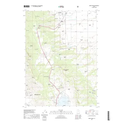
2020 Map of Mount Pisgah
USGS Topo · Published 2020About this map
Wellsville and Mount Sterling anchor the northern reaches of this modern topographic study, where the Wellsville Mountains descend into a complex network of canyons and hollows. The landscape is defined by its water management systems, including the Wellsville-Mendon Upper Canal and the Wellsville-Mendon Lower Canal that facilitate agriculture along the valley floor. To the south, the terrain rises toward Sardine Summit before dropping toward the community of Mantua and the adjacent Mantua Reservoir.
Find a feature on this map
106 named features on this map. Tap any name to fly to it.
Don’t see what you’re looking for? This feature index may not catch every label — zoom into the map to look around manually.
Map Details
Editions of this 2020 Mount Pisgah Map
This is the sole edition of this map. No revisions or reprints were ever made.
Other maps of this area

1914 · Logan
USGS Topo · 1:125,000

1916 · Logan
USGS Topo · 1:125,000

1954 · Ogden
USGS Topo · 1:250,000

1954 · Brigham City
USGS Topo · 1:250,000

1955 · Paradise
USGS Topo · 1:24,000

1955 · Mantua
USGS Topo · 1:24,000

1955 · James Peak
USGS Topo · 1:24,000

1955 · Willard
USGS Topo · 1:24,000

1955 · Mount Pisgah
USGS Topo · 1:24,000

1955 · Brigham City
USGS Topo · 1:24,000