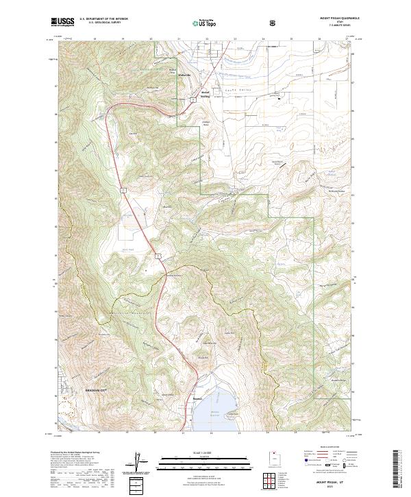
2023 Map of Mount Pisgah
USGS Topo · Published 2023About this map
The Wellsville Mountain Wilderness dominates the western skyline of this northern Utah landscape, where the high peaks of the Wasatch Range drop sharply toward the fertile floor of Cache Valley. The settlement of Wellsville serves as a primary hub in the north, while Mantua sits at the southern edge near the Mantua Reservoir. The terrain between these communities is defined by complex drainage patterns and canyon passes, most notably Sardine Canyon and the seasonal basin of Dry Lake. Historically significant water management is evident in the Wellsville-Mendon Upper Canal and Wellsville-Mendon Lower Canal, which reflect the region's long-standing reliance on irrigation for agriculture. The inclusion of Gold Mine Hill and family-named features like McMurdie Hollow and Lindleys Basin suggests a history of local resource extraction and early pioneer land use, while the Mount Sterling Cem provides a focal point for genealogical research in the area.
Find a feature on this map
108 named features on this map. Tap any name to fly to it.
Don’t see what you’re looking for? This feature index may not catch every label — zoom into the map to look around manually.
Map Details
Editions of this 2023 Mount Pisgah Map
This is the sole edition of this map. No revisions or reprints were ever made.
Other maps of this area

1914 · Logan
USGS Topo · 1:125,000

1916 · Logan
USGS Topo · 1:125,000

1954 · Ogden
USGS Topo · 1:250,000

1954 · Brigham City
USGS Topo · 1:250,000

1955 · Paradise
USGS Topo · 1:24,000

1955 · Mantua
USGS Topo · 1:24,000

1955 · James Peak
USGS Topo · 1:24,000

1955 · Willard
USGS Topo · 1:24,000

1955 · Mount Pisgah
USGS Topo · 1:24,000

1955 · Brigham City
USGS Topo · 1:24,000