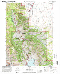
1998 Map of Mount Pisgah
USGS Topo · Published 2001About this map
The Wellsville Mountains dominate this 1990s landscape, forming a massive barrier between the developed corridor of Wellsville and the high basins to the south. This area serves as a critical transition between the residential edges of Cache Valley and the protected terrain of the Wellsville Mountain Wilderness. The settlement of Mantua sits near the southern edge, defined by its relationship with the Mantua Reservoir, while the northern portion shows the agricultural and water infrastructure of the Lower Canal and Upper Canal.
Find a feature on this map
90 named features on this map. Tap any name to fly to it.
Don’t see what you’re looking for? This feature index may not catch every label — zoom into the map to look around manually.
Map Details
Editions of this 1998 Mount Pisgah Map
This is the sole edition of this map. No revisions or reprints were ever made.
Other maps of this area

1914 · Logan
USGS Topo · 1:125,000

1916 · Logan
USGS Topo · 1:125,000

1954 · Ogden
USGS Topo · 1:250,000

1954 · Brigham City
USGS Topo · 1:250,000

1955 · Paradise
USGS Topo · 1:24,000

1955 · Mantua
USGS Topo · 1:24,000

1955 · James Peak
USGS Topo · 1:24,000

1955 · Willard
USGS Topo · 1:24,000

1955 · Mount Pisgah
USGS Topo · 1:24,000

1955 · Brigham City
USGS Topo · 1:24,000