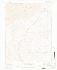
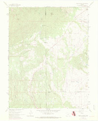
1961 Map of Mount Pittsburg
USGS Topo · Published 1978About this map
The Fort Carson Military Reservation dominates this Colorado landscape, where the high plains meet the rugged foothills. Topographical surveys from the late 1940s through 1961 document a terrain defined by named summits like Mount Pittsburg, Wild Mountain, and Timber Mountain. Human activity is concentrated along the drainages, with the Turkey Creek Ranch and Parris Mountaindale Ranch serving as rare landmarks in an area otherwise dedicated to military use and natural features. A small Landing Strip sits near Turkey Creek, reflecting the infrastructure needs of the era. To the west, the flat expanse of Table Mountain and the deep cut of Salt Canyon highlight the sharp elevation changes of the Fremont and El Paso county borders. This record captures the boundary zones of the military installation before subsequent modern developments altered the surrounding ranchlands.
Find a feature on this map
22 named features on this map. Tap any name to fly to it.
Don’t see what you’re looking for? This feature index may not catch every label — zoom into the map to look around manually.
Map Details
Editions of this 1961 Mount Pittsburg Map
8 editions found
Other maps of this area

1889 · Canon City
USGS Topo · 1:125,000

1891 · Pueblo
USGS Topo · 1:125,000

1892 · Canon City
USGS Topo · 1:125,000

1893 · Colorado Springs
USGS Topo · 1:125,000

1894 · Pikes Peak
USGS Topo · 1:125,000

1894 · Pueblo
USGS Topo · 1:125,000

1896 · Pueblo
USGS Topo · 1:125,000

1897 · Pueblo
USGS Topo · 1:125,000

1901 · Pikes Peak
USGS Topo · 1:125,000

1909 · Colorado Springs
USGS Topo · 1:125,000