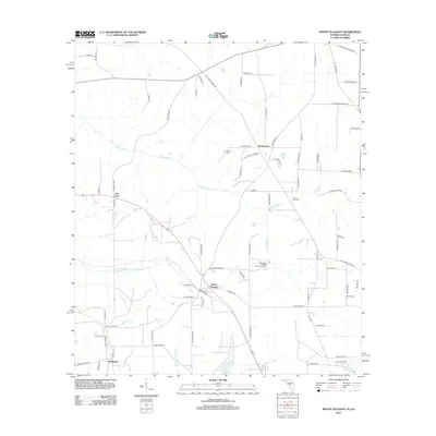
2012 Map of Mount Pleasant
USGS Topo · Published 2012About this map
Mount Pleasant serves as a central hub for this North Florida landscape, where the terrain is defined by the dendritic drainage patterns of N Mosquito Cr and S Mosquito Cr. The 2012 survey illustrates a dispersed rural settlement pattern characterized by numerous family-named roads and landmarks, such as F J Betts Pond and C W Thomas Lake. This area, situated along the Florida-Georgia border, maintains a strong communal identity rooted in its spiritual and ancestral sites, including the Centenary Church Camp Grounds and several local burying grounds like Mount Glory Cem and Hannatown Cem. The road network, featuring names like Hutchinson Ferry Rd and Old Post Office Loop, suggests a history of local commerce and connectivity between smaller hamlets like Oak Grove and Hardaway.
Find a feature on this map
76 named features on this map. Tap any name to fly to it.
Don’t see what you’re looking for? This feature index may not catch every label — zoom into the map to look around manually.
Map Details
Editions of this 2012 Mount Pleasant Map
This is the sole edition of this map. No revisions or reprints were ever made.
Other maps of this area

1954 · Tallahassee
USGS Topo · 1:250,000

1955 · Reynoldsville
USGS Topo · 1:24,000

1955 · Sycamore
USGS Topo · 1:24,000

1955 · Chattahoochee
USGS Topo · 1:24,000

1955 · Bainbridge
USGS Topo · 1:62,500

1955 · Mt Pleasant
USGS Topo · 1:24,000

1956 · Dogtown
USGS Topo · 1:24,000

1959 · Tallahassee
USGS Topo · 1:250,000

1959 · Gretna
USGS Topo · 1:24,000

1959 · Quincy
USGS Topo · 1:24,000