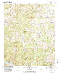
1989 Map of Mount Pleasant
USGS Topo · Published 1989About this map
The Mount Pleasant region along the border of Izard and Independence counties is defined by its deep hollows and high ridges above the White River. Small rural settlements like Gid and the Lafferty Community anchor the landscape, which is marked by several traditional local churches including Macedonia Ch and New Home Ch. The terrain is notably cave-rich, featuring landmarks such as Hankins Cave and Blowing Cave near the southern edge of the survey area.
Find a feature on this map
60 named features on this map. Tap any name to fly to it.
Don’t see what you’re looking for? This feature index may not catch every label — zoom into the map to look around manually.
Map Details
Editions of this 1989 Mount Pleasant Map
This is the sole edition of this map. No revisions or reprints were ever made.
Other maps of this area

1890 · Batesville
USGS Topo · 1:125,000

1891 · Batesville
USGS Topo · 1:125,000

1942 · Bethesda
USGS Topo · 1:24,000

1942 · Batesville
USGS Topo · 1:31,680

1942 · Mt Pleasant
USGS Topo · 1:31,680

1943 · Sandtown
USGS Topo · 1:24,000

1943 · Batesville
USGS Topo · 1:24,000

1951 · Melbourne
USGS Topo · 1:62,500

1953 · Memphis
USGS Topo · 1:250,000

1956 · Memphis
USGS Topo · 1:250,000