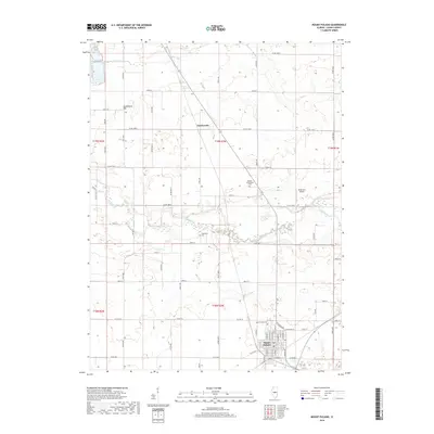
2018 Map of Mount Pulaski
USGS Topo · Published 2018About this map
Mount Pulaski serves as the primary hub of this Logan County landscape, situated where the high ground meets the bottomlands of Salt Creek. The town's grid is characterized by its proximity to the Mount Pulaski Cem, while the surrounding agricultural prairie is dotted with smaller, historic landmarks. To the north, the small settlement of Chestervale sits along the road network, while Lockenauer Hill provides one of the few prominent rises in the otherwise steady terrain. This 2018 survey reveals the persistent rural character of the region, where family and local history are preserved in sites like the Bowers-Templeman Cem and Downing Cem. The drainage patterns of Deer Cr and the meandering Salt Creek continue to shape the land use and property boundaries that have defined this central Illinois corridor for generations.
Find a feature on this map
69 named features on this map. Tap any name to fly to it.
Don’t see what you’re looking for? This feature index may not catch every label — zoom into the map to look around manually.
Map Details
Editions of this 2018 Mount Pulaski Map
This is the sole edition of this map. No revisions or reprints were ever made.
Other maps of this area

1911 · Lincoln
USGS Topo · 1:62,500

1913 · Lincoln
USGS Topo · 1:62,500

1954 · Niantic
USGS Topo · 1:62,500

1954 · Mechanicsburg
USGS Topo · 1:62,500

1957 · Kenney
USGS Topo · 1:62,500

1958 · Peoria
USGS Topo · 1:250,000

1958 · Decatur
USGS Topo · 1:250,000

1961 · Peoria
USGS Topo · 1:250,000

1961 · Decatur
USGS Topo · 1:250,000

1963 · Peoria
USGS Topo · 1:250,000