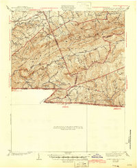
1939 Map of Mount Rogers
USGS Topo · Published 1946About this map
Mt Rogers towers over the high-country landscape of the Balsam Mountains and Iron Mountains, documenting the intersection of Virginia, North Carolina, and Tennessee in the mid-1930s. The settlement of Konnarock serves as a central hub for the region, complete with the Konnarock Girls Sch. The rail-dependent economy of these mountain communities is clearly defined by the Norfolk and Western Ry, which snakes through the steep terrain along Whitetop and Taylors Valley. This survey captures the wilderness infrastructure of the Jefferson National Forest during a period of transition, showing the early route of the Appalachian Trail as it traverses the peaks of Seng Mountain and Hurricane Mtn. Small rural life is preserved in the locations of Lebanon Ch, James Cem, and isolated schools like the Mud Creek Sch in Grayson County.
Find a feature on this map
58 named features on this map. Tap any name to fly to it.
Don’t see what you’re looking for? This feature index may not catch every label — zoom into the map to look around manually.
Map Details
Editions of this 1939 Mount Rogers Map
3 editions found
Other maps of this area

1889 · Wytheville
USGS Topo · 1:125,000

1889 · Wilkesboro
USGS Topo · 1:125,000

1891 · Abingdon
USGS Topo · 1:125,000

1891 · Wilkesboro
USGS Topo · 1:125,000

1892 · Wytheville
USGS Topo · 1:125,000

1893 · Cranberry
USGS Topo · 1:125,000

1894 · Abingdon
USGS Topo · 1:125,000

1895 · Cranberry
USGS Topo · 1:125,000

1899 · Cranberry
USGS Topo · 1:125,000

1902 · Cranberry
USGS Topo · 1:125,000