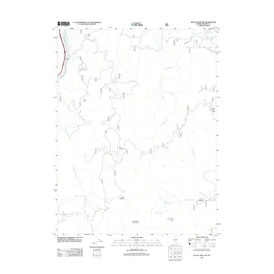
2012 Map of Mount Rose NW
USGS Topo · Published 2012About this map
Fleish sits along the bend of the Truckee River in the northwest corner of this Nevada landscape, where the terrain rises sharply into the high country of the Sierra Nevada. This area is defined by its complex drainage systems and seasonal mountain meadows, such as Big Meadows and Davis Meadow, which have historically served as critical landmarks for trans-Sierran travel and resource management. The map details a network of forest roads and remote water features, including Hunter Lake and the Hunter Creek Reservoir, illustrating the mid-century infrastructure required to manage water rights and fire access in this high-altitude environment. Peaks like Snowflower Mountain and Alpine Walk Peak anchor the southern portion of the quadrangle, while the presence of Dutch Louie Flats suggests localized history related to the region's early prospecting or ranching eras.
Find a feature on this map
21 named features on this map. Tap any name to fly to it.
Don’t see what you’re looking for? This feature index may not catch every label — zoom into the map to look around manually.
Map Details
Editions of this 2012 Mount Rose NW Map
This is the sole edition of this map. No revisions or reprints were ever made.
Other maps of this area

1890 · Sierraville
USGS Topo · 1:125,000

1891 · Carson
USGS Topo · 1:125,000

1891 · Truckee
USGS Topo · 1:125,000

1891 · Reno
USGS Topo · 1:125,000

1892 · Sierraville
USGS Topo · 1:125,000

1893 · Carson
USGS Topo · 1:125,000

1893 · Truckee
USGS Topo · 1:125,000

1893 · Reno
USGS Topo · 1:125,000

1894 · Sierraville
USGS Topo · 1:125,000

1895 · Truckee
USGS Topo · 1:125,000