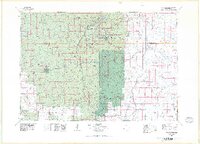
1977 Map of Mount Rushmore
USGS Topo · Published 1978About this map
Mount Rushmore National Memorial stands as the centerpiece of this study, which documents the complex land management and mining history of the southern Black Hills. The map traces a rugged corridor of national monuments and state lands, including Wind Cave National Park and Jewel Cave National Monument. Mining remains a significant presence in the landscape, with documented sites like the Holy Terror Mine near Keystone and the Spokane Mine. Beyond the granite faces and tourism corridors, the regional economy is defined by the Burlington Northern and Chicago and North Western rail lines serving ranching and timber communities like Pringle and Fairburn. Topographic details highlight the dramatic elevation shifts around Harney Peak and the famous granite formations of The Needles and Cathedral Spires.
Find a feature on this map
69 named features on this map. Tap any name to fly to it.
Don’t see what you’re looking for? This feature index may not catch every label — zoom into the map to look around manually.
Map Details
Editions of this 1977 Mount Rushmore Map
2 editions found
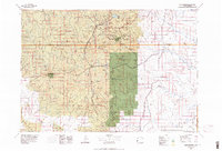
Other maps of this area

1893 · Rapid
USGS Topo · 1:125,000

1894 · Deadwood
USGS Topo · 1:125,000

1894 · Hermosa
USGS Topo · 1:125,000

1896 · Oelrichs
USGS Topo · 1:125,000

1896 · Harney Peak
USGS Topo · 1:125,000

1898 · Sundance
USGS Topo · 1:125,000

1898 · Rapid
USGS Topo · 1:125,000

1899 · Newcastle
USGS Topo · 1:125,000

1900 · Oelrichs
USGS Topo · 1:125,000

1901 · Hermosa
USGS Topo · 1:125,000