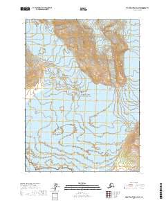
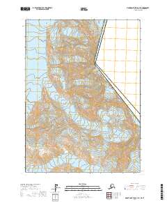
2017 Map of Mount Saint Elias A-4 SW
USGS Topo · Published 2017About this map
Wrangell-Saint Elias National Park dominates this 2017 survey, where massive ice fields meet the sea in the Alaska panhandle. The terrain is defined by the immense flow of the Hubbard Glacier and its tributary, the Valerie Glacier, as they move toward the coast. These glaciers carved a landscape of sharp elevation changes and dramatic drainage patterns that empty directly into the Gulf of Alaska. The map documents the state of the coastline and glacial extent in the early 21st century, providing a baseline for studying the shifting ice margins and maritime boundaries within the Yakutat City and Borough region.
Find a feature on this map
8 named features on this map. Tap any name to fly to it.
Don’t see what you’re looking for? This feature index may not catch every label — zoom into the map to look around manually.
Map Details
Editions of this 2017 Mount Saint Elias A-4 SW Map
This is the sole edition of this map. No revisions or reprints were ever made.
Other maps of this area

1951 · Yakutat
USGS Topo · 1:250,000

1951 · Mt Saint Elias
USGS Topo · 1:250,000

1959 · Yakutat D-4
USGS Topo · 1:63,360

1959 · Yakutat D-5
USGS Topo · 1:63,360

1959 · Yakutat
USGS Topo · 1:250,000

1959 · Mt Saint Elias
USGS Topo · 1:250,000
1985 · Mount Saint Elias A-5
USGS Topo · 1:63,360
1985 · Mount Saint Elias A-4
USGS Topo · 1:63,360
2017 · Mount Saint Elias A-4 NW
USGS Topo · 1:25,000
2017 · Mount Saint Elias A-4 SE
USGS Topo · 1:25,000