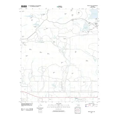
2010 Map of Mount Scott
USGS Topo · Published 2010About this map
Mount Scott rises as a prominent landmark in this region north of Lawton, overlooking a landscape defined by water management and cultural sites. The resort community of Medicine Park sits at the eastern edge near the massive Lake Lawtonka, while the specialized settlement of The Holy City occupies a site further west along Cedar Creek. This 2010 survey details an extensive network of dams and reservoirs, including Lake Elmer Thomas, Lake Jed Johnson, and Lake Rush, which have reshaped the drainage of Little Medicine Creek and Blue Beaver Creek.
Find a feature on this map
60 named features on this map. Tap any name to fly to it.
Don’t see what you’re looking for? This feature index may not catch every label — zoom into the map to look around manually.
Map Details
Editions of this 2010 Mount Scott Map
This is the sole edition of this map. No revisions or reprints were ever made.
Other maps of this area

1937 · Cache
USGS Topo · 1:48,000

1937 · Quanah Mountain
USGS Topo · 1:24,000

1942 · Cache
USGS Topo · 1:62,500

1946 · Lawton
USGS Topo · 1:62,500

1949 · Mount Scott
USGS Topo · 1:24,000

1949 · Quanah Mountain
USGS Topo · 1:24,000

1949 · Fort Sill
USGS Topo · 1:24,000

1950 · Saddle Mountain
USGS Topo · 1:62,500

1955 · Lawton
USGS Topo · 1:250,000

1956 · Post Oak Creek
USGS Topo · 1:24,000