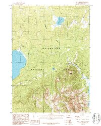
1986 Map of Mount Sheridan
USGS Topo · Published 1986About this map
The Continental Divide winds through this high-altitude landscape within Yellowstone National Park, marking the watershed between the Pacific and Atlantic drainages. In the mid-1980s, this area remained an inaccessible wilderness dominated by the soaring peaks of the Red Mountains and the volcanic activity of the Heart Lake Geyser Basin. The map captures the remote character of the backcountry where Mount Sheridan and Factory Hill look down upon geothermal features like Rustic Geyser. A network of Pack Trail routes and Footbridges provides the only infrastructure through the dense terrain, connecting major bodies of water such as Lewis Lake, Riddle Lake, and the northwestern corner of Heart Lake. The intricate drainage patterns of Aster Creek and Witch Creek illustrate the complex hydrology typical of this active thermal region.
Find a feature on this map
18 named features on this map. Tap any name to fly to it.
Don’t see what you’re looking for? This feature index may not catch every label — zoom into the map to look around manually.
Map Details
Editions of this 1986 Mount Sheridan Map
2 editions found
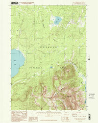
Other maps of this area

1885 · Lake
USGS Topo · 1:125,000

1886 · Shoshone
USGS Topo · 1:125,000

1888 · Shoshone
USGS Topo · 1:125,000

1895 · Shoshone
USGS Topo · 1:125,000

1895 · Lake
USGS Topo · 1:125,000

1896 · Lake
USGS Topo · 1:125,000

1901 · Shoshone
USGS Topo · 1:125,000

1901 · Lake
USGS Topo · 1:125,000

1906 · Lake
USGS Topo · 1:125,000

1908 · Shoshone
USGS Topo · 1:125,000