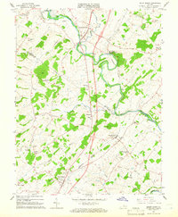
1964 Map of Mount Sidney
USGS Topo · Published 1966About this map
Mount Sidney and Mount Crawford anchor this mid-1960s study of the Shenandoah Valley, where the North River meanders across the Rockingham and Augusta county line. The landscape is defined by its agrarian roots and aviation development, featuring both the Bridgewater Air Park and the Shenandoah Valley Airport. The Chesapeake Western railroad follows the river valley, connecting smaller communities like Burketown and Weyers Cave. Local genealogy is well-preserved through numerous rural landmarks, including St Michaels Ch, Friedens Ch, and family-named burial sites such as Sellers Cem and Bells Cem. The map captures the region before extensive modern development, showing the traditional crossroads and river bends that have long shaped this part of Virginia.
Find a feature on this map
44 named features on this map. Tap any name to fly to it.
Don’t see what you’re looking for? This feature index may not catch every label — zoom into the map to look around manually.
Map Details
Editions of this 1964 Mount Sidney Map
4 editions found
Other maps of this area

1892 · Harrisonburg
USGS Topo · 1:125,000

1894 · Staunton
USGS Topo · 1:125,000

1934 · Waynesboro
USGS Topo · 1:48,000

1939 · Waynesboro
USGS Topo · 1:62,500

1941 · Harrisonburg
USGS Topo · 1:62,500

1943 · Harrisonburg
USGS Topo · 1:62,500

1944 · Parnassus
USGS Topo · 1:62,500

1944 · Staunton
USGS Topo · 1:62,500

1947 · Staunton
USGS Topo · 1:62,500

1947 · Parnassus
USGS Topo · 1:62,500