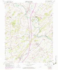
1964 Map of Mount Sidney
USGS Topo · Published 1983About this map
Mount Sidney and the rural communities of the Shenandoah Valley are documented in this mid-century topographic record, which spans the border of Rockingham Co and Augusta Co. The North River and its tributaries, including Cooks Creek and Naked Creek, form the central drainage of this agricultural landscape. Local industry and infrastructure are represented by Wise Mill and the Chesapeake Western railroad, which threads through Mount Crawford and Weyers Cave. Aviation history is well-marked on this sheet, featuring both the Bridgewater Air Park in the north and the Shenandoah Valley Airport in the south. Genealogists will find a wealth of specific landmarks, from Bethany Church and Union Chapel to smaller family-named sites like Bells Cemetery and Landes Cemetery. The inclusion of Seawright Springs and the early sewage disposal facilities near Bridgewater provides a look at the water resources and early utility development of the era.
Find a feature on this map
40 named features on this map. Tap any name to fly to it.
Don’t see what you’re looking for? This feature index may not catch every label — zoom into the map to look around manually.
Map Details
Editions of this 1964 Mount Sidney Map
4 editions found
Other maps of this area

1892 · Harrisonburg
USGS Topo · 1:125,000

1894 · Staunton
USGS Topo · 1:125,000

1934 · Waynesboro
USGS Topo · 1:48,000

1939 · Waynesboro
USGS Topo · 1:62,500

1941 · Harrisonburg
USGS Topo · 1:62,500

1943 · Harrisonburg
USGS Topo · 1:62,500

1944 · Parnassus
USGS Topo · 1:62,500

1944 · Staunton
USGS Topo · 1:62,500

1947 · Staunton
USGS Topo · 1:62,500

1947 · Parnassus
USGS Topo · 1:62,500