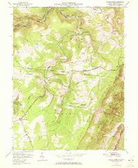
1949 Map of Mount Storm
USGS Topo · Published 1972About this map
The Allegheny Front dominates this mid-century survey, where the rugged terrain of the Potomac State Forest meets the industrial activity of West Virginia's coal country. Several strip mines are etched into the hillsides above the Western Maryland railroad line, which tracks the winding North Branch of the Potomac River. This era shows a network of upland settlements and rural institutions, including the White Hall Sch and numerous community landmarks like Blake Chapel and the Rehoboth Ch. Local genealogy is well-supported by clearly marked family grounds such as the Schaeffer Cem and Kathbaugh Cem. The industrial and agricultural character of the region is visible in the placement of hamlets like Emoryville and Sulphur City along the tributaries of Abram Creek.
Find a feature on this map
43 named features on this map. Tap any name to fly to it.
Don’t see what you’re looking for? This feature index may not catch every label — zoom into the map to look around manually.
Map Details
Editions of this 1949 Mount Storm Map
4 editions found
Other maps of this area

1895 · Piedmont
USGS Topo · 1:125,000

1899 · Oakland
USGS Topo · 1:62,500

1900 · Oakland
USGS Topo · 1:62,500

1916 · Davis
USGS Topo · 1:48,000

1918 · Davis
USGS Topo · 1:62,500

1919 · Elk Garden
USGS Topo · 1:48,000

1919 · Davis
USGS Topo · 1:62,500

1920 · Elk Garden
USGS Topo · 1:48,000

1920 · Davis
USGS Topo · 1:48,000

1921 · Greenland Gap
USGS Topo · 1:62,500