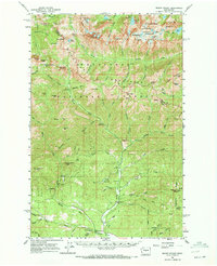
1961 Map of Mount Stuart
USGS Topo · Published 1972About this map
Mount Stuart and the surrounding Wenatchee Mountains dominate this 1961 field-checked survey, revealing a landscape defined by alpine lakes and high-elevation terrain. The map captures the remote character of the Wenatchee National Forest, where established sites like De Roux Forest Camp and Beverly Forest Camp supported early recreational access. Resource extraction and forest management are evident through features like the Skookum Mine, several unnamed prospects near Gallagher Head, and the Stafford Lookout positioned for fire watch over Stafford Creek.
Find a feature on this map
100 named features on this map. Tap any name to fly to it.
Don’t see what you’re looking for? This feature index may not catch every label — zoom into the map to look around manually.
Map Details
Editions of this 1961 Mount Stuart Map
3 editions found

Other maps of this area

1897 · Mount Stuart
USGS Topo · 1:125,000

1901 · Chiwaukum
USGS Topo · 1:125,000

1901 · Snoqualmie Pass
USGS Topo · 1:125,000

1902 · Skykomish
USGS Topo · 1:125,000

1902 · Mount Stuart
USGS Topo · 1:125,000

1903 · Snoqualmie
USGS Topo · 1:125,000

1904 · Chiwaukum
USGS Topo · 1:125,000

1905 · Skykomish
USGS Topo · 1:125,000

1957 · Wenatchee
USGS Topo · 1:250,000

1958 · Thorp
USGS Topo · 1:62,500