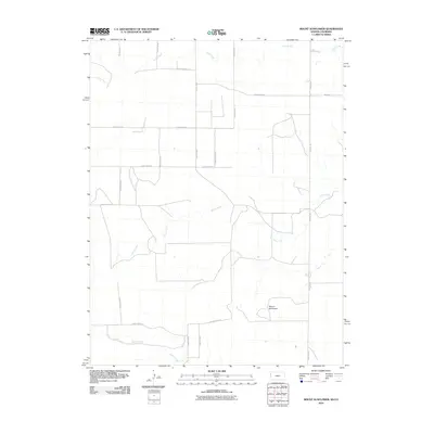
2010 Map of Mount Sunflower
USGS Topo · Published 2010About this map
Mount Sunflower, the highest point in Kansas, rises within this section of Wallace County near the Colorado border. The landscape is defined by the high plains drainage patterns of Turtle Creek, Goose Creek, and Willow Creek, which meander through a geometric grid of rural roads. This 2010 survey illustrates the remote agricultural character of the region, where long-established section lines are traced by thoroughfares like County Rd 57 and Road Wa-N3. The transition between the Kansas and Colorado coordinate systems occurs here, marking a significant survey boundary. While settlements are absent from this specific quadrangle, the network of routes such as County Road E and County Road EE reveals the infrastructure supporting the sprawling ranchlands and farms at the state's western edge.
Find a feature on this map
17 named features on this map. Tap any name to fly to it.
Don’t see what you’re looking for? This feature index may not catch every label — zoom into the map to look around manually.
Map Details
Editions of this 2010 Mount Sunflower Map
This is the sole edition of this map. No revisions or reprints were ever made.
Other maps of this area

1892 · Cheyenne Wells
USGS Topo · 1:125,000

1894 · Cheyenne Wells
USGS Topo · 1:125,000

1954 · Limon
USGS Topo · 1:250,000

1954 · Lamar
USGS Topo · 1:250,000

1954 · Goodland
USGS Topo · 1:250,000

1955 · Scott City
USGS Topo · 1:250,000

1956 · Goodland
USGS Topo · 1:250,000

1957 · Limon
USGS Topo · 1:250,000

1957 · Goodland
USGS Topo · 1:250,000

1958 · Limon
USGS Topo · 1:250,000