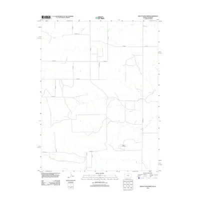
2012 Map of Mount Sunflower
USGS Topo · Published 2012About this map
Mount Sunflower, the highest point in Kansas, anchors this high plains landscape in Wallace County. Located near the Colorado border, the terrain is defined by a sparse but essential network of seasonal drainage systems including Turtle Cr in the north and the winding Goose Cr across the center. The map reveals the rigid section-line organization of the American West, where a grid of rural routes such as Co Road E and Co Rd-58 facilitate movement across the open range. In the south, Willow Cr and Co Road EE mark the transition toward the Smoky Hill River valley. This 2012 survey illustrates the modern agricultural and ranching infrastructure that persists in one of the most sparsely populated reaches of the Great Plains, where the land remains largely open and undeveloped except for these gravel roads and intermittent watercourses.
Find a feature on this map
17 named features on this map. Tap any name to fly to it.
Don’t see what you’re looking for? This feature index may not catch every label — zoom into the map to look around manually.
Map Details
Editions of this 2012 Mount Sunflower Map
This is the sole edition of this map. No revisions or reprints were ever made.
Other maps of this area
1892 · Cheyenne Wells
USGS Topo · 1:125,000
1894 · Cheyenne Wells
USGS Topo · 1:125,000

1954 · Limon
USGS Topo · 1:250,000

1954 · Lamar
USGS Topo · 1:250,000

1954 · Goodland
USGS Topo · 1:250,000

1955 · Scott City
USGS Topo · 1:250,000

1956 · Goodland
USGS Topo · 1:250,000

1957 · Limon
USGS Topo · 1:250,000

1957 · Goodland
USGS Topo · 1:250,000

1958 · Limon
USGS Topo · 1:250,000