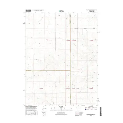
2015 Map of Mount Sunflower
USGS Topo · Published 2015About this map
Mt Sunflower stands as the primary landmark on this High Plains landscape, situated along the border where Colorado and Kansas meet. The terrain is defined by the ephemeral drainage patterns of Goose Creek, Turtle Creek, and Willow Creek, which carve subtle valleys across the expansive grasslands of Wallace and Cheyenne Counties. A network of rural section-line roads, such as Co RD 59 and Co RD B, facilitates travel through this remote agricultural region. The map provides a detailed look at the 2015 layout of these townships, revealing the intersections of county lines and range boundaries that have organized this territory since the early days of settlement. The placement of modern local routes like Xpressway Rd and Crimson Cloud Rd illustrates the continued use of this landscape for ranching and transit in the 21st century.
Find a feature on this map
28 named features on this map. Tap any name to fly to it.
Don’t see what you’re looking for? This feature index may not catch every label — zoom into the map to look around manually.
Map Details
Editions of this 2015 Mount Sunflower Map
This is the sole edition of this map. No revisions or reprints were ever made.
Other maps of this area

1892 · Cheyenne Wells
USGS Topo · 1:125,000

1894 · Cheyenne Wells
USGS Topo · 1:125,000

1954 · Limon
USGS Topo · 1:250,000

1954 · Lamar
USGS Topo · 1:250,000

1954 · Goodland
USGS Topo · 1:250,000

1955 · Scott City
USGS Topo · 1:250,000

1956 · Goodland
USGS Topo · 1:250,000

1957 · Limon
USGS Topo · 1:250,000

1957 · Goodland
USGS Topo · 1:250,000

1958 · Limon
USGS Topo · 1:250,000