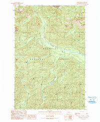
1990 Map of Mount Tebo
USGS Topo · Published 1990About this map
The Skokomish River and its South Fork carve a deep drainage through the Olympic Peninsula, anchoring a landscape dominated by the high peaks of the Olympic National Forest. This 1990 provisional survey documents a rugged interior before the full transition of modern land management, where remote water bodies like Spider Lake and Pine Lake sit tucked between steep ridges. The map highlights the protected high country of the Wonder Mountain Wilderness in the north, while the southern reaches track the headwaters of the Middle Fork Satsop River and the Canyon River. Prominent summits including Mount Tebo, Capitol Peak, and Mount Church provide critical orientation points for hikers and surveyors. The presence of a Borrow Pit suggests the ongoing maintenance of the few forest roads that penetrate this dense mountain terrain, illustrating the balance between resource access and wilderness preservation.
Find a feature on this map
25 named features on this map. Tap any name to fly to it.
Don’t see what you’re looking for? This feature index may not catch every label — zoom into the map to look around manually.
Map Details
Editions of this 1990 Mount Tebo Map
This is the sole edition of this map. No revisions or reprints were ever made.
Other maps of this area

1921 · Satsop
USGS Topo · 1:62,500

1938 · Mt Constance
USGS Topo · 1:125,000

1947 · Mt. Steel
USGS Topo · 1:62,500

1947 · Mt Christie
USGS Topo · 1:62,500

1950 · Mt Christie
USGS Topo · 1:62,500

1950 · Mt. Steel
USGS Topo · 1:62,500

1953 · Mt Tebo
USGS Topo · 1:62,500

1955 · Grisdale
USGS Topo · 1:62,500

1958 · Seattle
USGS Topo · 1:250,000

1962 · Seattle
USGS Topo · 1:250,000