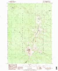
1985 Map of Mount Thielsen
USGS Topo · Published 1985About this map
Mount Thielsen and the high volcanic terrain of the Cascades dominate this mid-1980s survey along the border of Douglas and Klamath counties. The landscape is defined by the sharp divide of Sawtooth Ridge, which separates the Umpqua National Forest to the west from the Winema National Forest to the east. At the heart of the map, the Lathrop Glacier sits on the steep northern slopes of the peak, a rare glacial feature in this high-altitude wilderness.
Find a feature on this map
24 named features on this map. Tap any name to fly to it.
Don’t see what you’re looking for? This feature index may not catch every label — zoom into the map to look around manually.
Map Details
Editions of this 1985 Mount Thielsen Map
This is the sole edition of this map. No revisions or reprints were ever made.
Other maps of this area

1917 · Diamond Lake
USGS Topo · 1:125,000

1935 · Chemult
USGS Topo · 1:96,000

1941 · Chemult
USGS Topo · 1:125,000

1955 · Crescent
USGS Topo · 1:250,000

1956 · Diamond Lake
USGS Topo · 1:62,500

1956 · Summit Lake
USGS Topo · 1:62,500

1957 · Crescent
USGS Topo · 1:250,000

1958 · Crescent
USGS Topo · 1:250,000

1958 · Roseburg
USGS Topo · 1:250,000

1959 · Roseburg
USGS Topo · 1:250,000