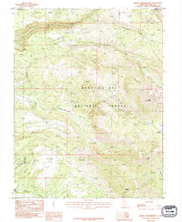
1987 Map of Mount Tukuhnikivatz
USGS Topo · Published 1987About this map
Mount Tukuhnikivatz and South Mountain dominate this high-altitude landscape in the heart of the Manti-La Sal National Forest. Surveyed in the 1980s, the map reveals a rugged drainage network where Mill Creek and Brumley Ridge define the northern terrain, transitioning southward into the broad alpine reaches of Slaughter Flats and the descent of Black Ridge. The presence of Gold Basin and several marked Prospect sites suggests a history of mineral exploration tucked into the canyons. This region, straddling the boundary of Grand and San Juan counties, is characterized by its high basins and complex hydrology, from the headwaters of Pack Creek to the isolated waters of Clark Lake. The detailed topography across La Sal Pass illustrates the primary passage through these peaks, connecting the western slopes to the deep reaches of Pole Canyon.
Find a feature on this map
26 named features on this map. Tap any name to fly to it.
Don’t see what you’re looking for? This feature index may not catch every label — zoom into the map to look around manually.
Map Details
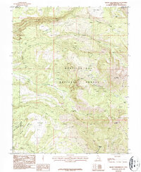
Editions of this 1987 Mount Tukuhnikivatz Map
2 editions found
Other maps of this area

1885 · La Sal
USGS Topo · 1:250,000

1954 · Mt. Waas 4 SW
USGS Topo · 1:24,000

1954 · Mt Peale 1 SW
USGS Topo · 1:24,000

1954 · Mt Peale 1 NW
USGS Topo · 1:24,000

1954 · Mt Peale 2 SW
USGS Topo · 1:24,000

1954 · Mt Peale 2 NW
USGS Topo · 1:24,000

1954 · Mt Peale 2 SE
USGS Topo · 1:24,000

1954 · Mt. Waas 3 SE
USGS Topo · 1:24,000

1954 · Mt Peale 2 NE
USGS Topo · 1:24,000

1954 · Mt. Waas 3 SW
USGS Topo · 1:24,000