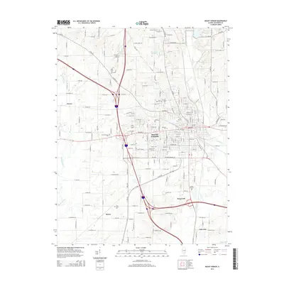
2015 Map of Mount Vernon
USGS Topo · Published 2015About this map
Mount Vernon serves as the central hub of this 2015 study, illustrating a landscape defined by its historical cemeteries and the convergence of several major regional drainage systems. The city's growth is framed by the Casey Fork to the east and the winding course of the Big Muddy River to the west. A notable density of burial grounds, including Oakwood Cem, Old Union Cem, and Saint Marys Cem, provides a detailed record of local genealogy and early church settlements. Outside the urban core, smaller communities such as Drivers, Morganville, and Marcoe maintain their distinct positions near tributaries like Harper Cr and Pierce Cr. The map also details water features like Peckerwood Lake and Hawthorne Hills Lake, alongside the modern transportation corridors that have reshaped the outskirts of this Jefferson County seat.
Find a feature on this map
174 named features on this map. Tap any name to fly to it.
Don’t see what you’re looking for? This feature index may not catch every label — zoom into the map to look around manually.
Map Details
Editions of this 2015 Mount Vernon Map
This is the sole edition of this map. No revisions or reprints were ever made.
Other maps of this area

1926 · Duquoin
USGS Topo · 1:62,500

1933 · Mount Vernon
USGS Topo · 1:48,000

1939 · Ina
USGS Topo · 1:62,500

1940 · Mount Vernon
USGS Topo · 1:62,500

1943 · Ina
USGS Topo · 1:62,500

1943 · Ashley
USGS Topo · 1:62,500

1946 · Ashley
USGS Topo · 1:62,500

1958 · Belleville
USGS Topo · 1:250,000

1962 · Belleville
USGS Topo · 1:250,000

1964 · Opdyke
USGS Topo · 1:24,000
Featured Places
- Mount Vernon, IL
- Drivers, IL
- Webster Hill Estates, Mount Vernon
- Morganville, Mount Vernon
- Bakerville, IL