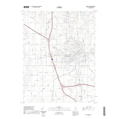
2021 Map of Mount Vernon
USGS Topo · Published 2021About this map
Mount Vernon serves as the central hub of this modern survey, where established residential grids meet a complex network of interstate and local roads. The landscape is defined by its water management and cemeteries, featuring the large Louisville and Nashville Reservoir and numerous smaller bodies like Peckerwood Lake and Hawthorne Hills Lake. These reservoirs and the Big Muddy River provide a stark contrast to the surrounding agricultural and industrial zones that extend toward peripheral settlements like Drivers and Bakerville.
Find a feature on this map
102 named features on this map. Tap any name to fly to it.
Don’t see what you’re looking for? This feature index may not catch every label — zoom into the map to look around manually.
Map Details
Editions of this 2021 Mount Vernon Map
This is the sole edition of this map. No revisions or reprints were ever made.
Other maps of this area

1926 · Duquoin
USGS Topo · 1:62,500

1933 · Mount Vernon
USGS Topo · 1:48,000

1939 · Ina
USGS Topo · 1:62,500

1940 · Mount Vernon
USGS Topo · 1:62,500

1943 · Ina
USGS Topo · 1:62,500

1943 · Ashley
USGS Topo · 1:62,500

1946 · Ashley
USGS Topo · 1:62,500

1958 · Belleville
USGS Topo · 1:250,000

1962 · Belleville
USGS Topo · 1:250,000

1964 · Opdyke
USGS Topo · 1:24,000
Featured Places
- Mount Vernon, IL
- Drivers, IL
- Webster Hill Estates, Mount Vernon
- Morganville, Mount Vernon
- Bakerville, IL