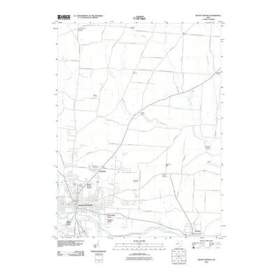
2010 Map of Mount Vernon
USGS Topo · Published 2010About this map
The Kokosing River defines the southern landscape of this central Ohio region, where the city of Mount Vernon serves as a primary hub of settlement. The map reveals a dense network of local roads and established institutions, including the expansive Mount Vernon State Institute and the Knox County Fairgrounds near Academia. Smaller outlying communities like Amity and Gambier are connected by historical routes such as the Fredericktown Amity Rd.
Find a feature on this map
86 named features on this map. Tap any name to fly to it.
Don’t see what you’re looking for? This feature index may not catch every label — zoom into the map to look around manually.
Map Details
Editions of this 2010 Mount Vernon Map
This is the sole edition of this map. No revisions or reprints were ever made.
Other maps of this area

1912 · Gambier
USGS Topo · 1:62,500

1912 · Perrysville
USGS Topo · 1:62,500

1914 · Gambier
USGS Topo · 1:62,500

1915 · Perrysville
USGS Topo · 1:62,500

1915 · Shauck
USGS Topo · 1:62,500

1915 · Fredericktown
USGS Topo · 1:62,500

1943 · Shauck
USGS Topo · 1:62,500

1943 · Gambier
USGS Topo · 1:62,500

1943 · Fredericktown
USGS Topo · 1:62,500

1944 · Perrysville
USGS Topo · 1:62,500