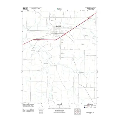
2011 Map of Mount Vernon
USGS Topo · Published 2011About this map
Mount Vernon serves as the regional hub for this Lawrence County landscape, shown here as a structured grid of rural roads and watercourses. The town’s layout transitions from its central core to the industrial and commercial activity flanking Interstate 44, while smaller settlements like Hoberg and Opal remain as important local nodes. The terrain is defined by the northward flow of Williams Creek and the meandering paths of Honey Creek and the Spring River to the south. Numerous family-named burial grounds, including the Spanish Fort Cemetery, Williams Cemetery, and Smith Cemetery, are scattered across the quadrangle, indicating deep genealogical roots in the surrounding farmland. Modern infrastructure such as a Landing Strip and the Southwest Research Center Dam sits alongside these older landmarks, illustrating the continued agricultural and technical development of the Missouri Ozark plateau region during the early twenty-first century.
Find a feature on this map
77 named features on this map. Tap any name to fly to it.
Don’t see what you’re looking for? This feature index may not catch every label — zoom into the map to look around manually.
Map Details
Editions of this 2011 Mount Vernon Map
This is the sole edition of this map. No revisions or reprints were ever made.
Other maps of this area

1886 · Greenfield
USGS Topo · 1:125,000

1888 · Greenfield
USGS Topo · 1:125,000

1919 · Halltown
USGS Topo · 1:62,500

1921 · Stotts City
USGS Topo · 1:62,500

1942 · Aurora
USGS Topo · 1:62,500

1943 · Monett
USGS Topo · 1:62,500

1945 · Harrison
USGS Topo · 1:250,000

1945 · Aurora
USGS Topo · 1:62,500

1949 · Harrison
USGS Topo · 1:250,000

1954 · Harrison
USGS Topo · 1:250,000