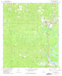
1982 Map of Mount Vernon
USGS Topo · Published 1982About this map
Mt Vernon and the expansive Searcy State Hospital complex dominate the eastern landscape of this Mobile County study, situated where the high ground meets the western banks of the Mobile River. The 1982 topography reveals a region defined by its rail-and-river economy, with both the Southern and Burlington Northern railroads running parallel to the river through settlements like Movico, Chastang, and Bucks. West of the river corridor, the terrain transitions into a dense network of creek branches and named groves, including the evocative Stage Coach Woods and Cedar Creek Falls.
Find a feature on this map
46 named features on this map. Tap any name to fly to it.
Don’t see what you’re looking for? This feature index may not catch every label — zoom into the map to look around manually.
Map Details
Editions of this 1982 Mount Vernon Map
2 editions found
Other maps of this area

1941 · Bay Minette
USGS Topo · 1:62,500

1941 · Creola
USGS Topo · 1:62,500

1943 · Creola
USGS Topo · 1:62,500

1943 · Bay Minette
USGS Topo · 1:62,500

1943 · Tensaw
USGS Topo · 1:62,500

1943 · Citronelle
USGS Topo · 1:62,500

1944 · Tensaw
USGS Topo · 1:62,500

1946 · Citronelle
USGS Topo · 1:62,500

1953 · Andalusia
USGS Topo · 1:250,000

1953 · Hattiesburg
USGS Topo · 1:250,000