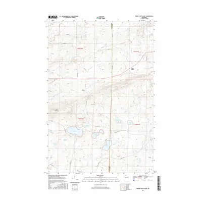
2015 Map of Mount Whittlesey
USGS Topo · Published 2015About this map
Mount Whittlesey rises as a prominent landmark in this northern Wisconsin landscape, where the border of Ashland Co and Iron Co divides a region defined by its dense network of waterways and glacial lakes. Small settlements like Ballou and Tyler Forks are situated among a complex hydrology that includes the Bad River and the headwaters of numerous creeks such as Montreal Cr and Devils Cr. The map reveals a high concentration of named water bodies in the southern half, including the expansive Lake Galilee, Eureka Lake, and Lake Caroline. This 2015 survey illustrates a modern road network including Red House Rd and Caroline Lake Rd, which provide access to these isolated lakes. The terrain is further characterized by the numerous smaller basins of McCarthy Lake, Maki Lake, and Twin Lakes, reflecting the post-glacial topography of the Wisconsin Northwoods.
Find a feature on this map
38 named features on this map. Tap any name to fly to it.
Don’t see what you’re looking for? This feature index may not catch every label — zoom into the map to look around manually.
Map Details
Editions of this 2015 Mount Whittlesey Map
This is the sole edition of this map. No revisions or reprints were ever made.
Other maps of this area

1940 · Butternut
USGS Topo · 1:48,000

1940 · Upson
USGS Topo · 1:48,000

1942 · Glidden
USGS Topo · 1:48,000

1942 · Mellen
USGS Topo · 1:48,000

1943 · Upson
USGS Topo · 1:48,000

1945 · Glidden
USGS Topo · 1:48,000

1945 · Mellen
USGS Topo · 1:48,000

1947 · Butternut
USGS Topo · 1:48,000

1950 · Butternut
USGS Topo · 1:48,000

1953 · Ashland
USGS Topo · 1:250,000