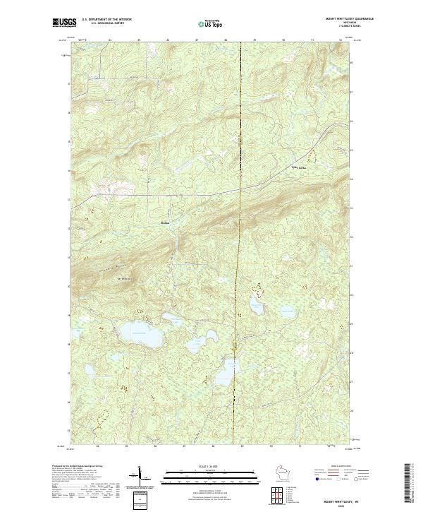
2022 Map of Mount Whittlesey
USGS Topo · Published 2022About this map
The Gogebic Range dominates this portion of northern Wisconsin, where the namesake Mt Whittlesey rises above a landscape defined by glacial lakes and headwater streams. This recent survey illustrates a terrain of high plateaus and dense hydrography, including the settlements of Tyler Forks and Ballou. These small communities are situated along the edges of the highland, providing access to the numerous water bodies that dot the region, such as Lake Galilee, Caroline Lake, and Snowshoe Lake. The topography reveals the intricate drainage patterns of the Bad River and Montreal Cr, which carve through the ancient bedrock of the range. Numerous family-named roads like Becker Rd and Flesia Rd hint at the enduring rural footprint in Ashland and Iron counties, where logging and seasonal recreation have long shaped the local economy.
Find a feature on this map
42 named features on this map. Tap any name to fly to it.
Don’t see what you’re looking for? This feature index may not catch every label — zoom into the map to look around manually.
Map Details
Editions of this 2022 Mount Whittlesey Map
This is the sole edition of this map. No revisions or reprints were ever made.
Other maps of this area

1940 · Butternut
USGS Topo · 1:48,000

1940 · Upson
USGS Topo · 1:48,000

1942 · Glidden
USGS Topo · 1:48,000

1942 · Mellen
USGS Topo · 1:48,000

1943 · Upson
USGS Topo · 1:48,000

1945 · Glidden
USGS Topo · 1:48,000

1945 · Mellen
USGS Topo · 1:48,000

1947 · Butternut
USGS Topo · 1:48,000

1950 · Butternut
USGS Topo · 1:48,000

1953 · Ashland
USGS Topo · 1:250,000