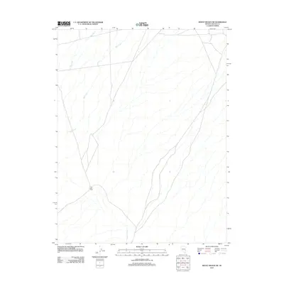
2012 Map of Mount Wilson SW
USGS Topo · Published 2012About this map
Eight Mile Ranch sits at a junction of backcountry routes in this high-desert portion of Lincoln County. The landscape is defined by the drainage patterns of Patterson Wash, which draws seasonal water from the surrounding highlands via Hulse Creek and Page Creek. These watercourses create a distinct dendritic pattern across the terrain, illustrating how moisture moves through this arid basin-and-range environment. The presence of a named ranch in this isolated section of Nevada suggests a long-standing reliance on the scattered springs and intermittent creeks that support livestock in an otherwise challenging environment. This 2012 survey captures the spatial relationship between these vital water sources and the singular habitation that anchors the area's geography.
Find a feature on this map
4 named features on this map. Tap any name to fly to it.
Don’t see what you’re looking for? This feature index may not catch every label — zoom into the map to look around manually.
Map Details
Editions of this 2012 Mount Wilson SW Map
This is the sole edition of this map. No revisions or reprints were ever made.
Other maps of this area

1885 · Pioche
USGS Topo · 1:250,000

1886 · Pioche
USGS Topo · 1:250,000

1915 · Bristol Range
USGS Topo · 1:62,500

1916 · Highland
USGS Topo · 1:62,500

1917 · Bristol Range
USGS Topo · 1:62,500

1918 · Highland
USGS Topo · 1:62,500

1921 · NW 1/4 Panaca
USGS Topo · 1:48,000

1953 · Highland Peak
USGS Topo · 1:24,000

1953 · Bristol Range SE
USGS Topo · 1:24,000

1953 · Pioche
USGS Topo · 1:24,000