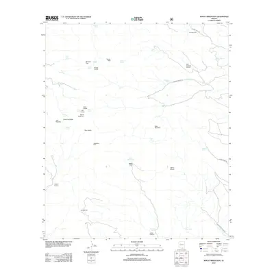
2012 Map of Mount Wrightson
USGS Topo · Published 2012About this map
Mount Wrightson and Josephine Peak dominate the high-elevation terrain of this Arizona survey, marking the dramatic topography of the Santa Rita Mountains. The landscape is defined by its complex network of springs and canyons, essential water sources in this arid environment. Significant landmarks like Dutch John Spring, Florida Spring, and Aliso Spring are scattered across the slopes, supporting a history of ranching and land use evidenced by features such as Fish Well Corral and Fish Canyon Tank.
Find a feature on this map
44 named features on this map. Tap any name to fly to it.
Don’t see what you’re looking for? This feature index may not catch every label — zoom into the map to look around manually.
Map Details
Editions of this 2012 Mount Wrightson Map
This is the sole edition of this map. No revisions or reprints were ever made.
Other maps of this area

1904 · Patagonia
USGS Topo · 1:125,000

1905 · Patagonia
USGS Topo · 1:125,000

1922 · Agus Caliente
USGS Topo · 1:62,500

1926 · Helvetia
USGS Topo · 1:62,500

1932 · Elgin
USGS Topo · 1:62,500

1940 · Elgin
USGS Topo · 1:62,500

1947 · Elgin
USGS Topo · 1:62,500

1948 · Sonoita
USGS Topo · 1:24,000
1948 · Mt. Hughes
USGS Topo · 1:24,000

1956 · Nogales
USGS Topo · 1:250,000