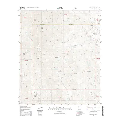
2014 Map of Mount Wrightson
USGS Topo · Published 2014About this map
Mount Wrightson serves as the focal point for this 2014 survey of the southern Santa Rita Mountains, where the boundary between Pima and Santa Cruz counties traverses high-altitude terrain. The map documents the extensive network of canyons and peaks protected within the Coronado National Forest, including the prominent McCleary Peak and Josephine Peak. Significant for recreational and environmental history, the Arizona National Scenic Trail is traced as it winds through the landscape, passing through Walker Basin and over several mountain saddles. This data reflects a modern era of land management, highlighting numerous water sources critical to the arid environment, such as Florida Spring and Bog Springs. Local history is embedded in the naming of topographical features like Kentucky Gulch and Mansfield Canyon, which point toward the region's earlier mining and ranching associations.
Find a feature on this map
75 named features on this map. Tap any name to fly to it.
Don’t see what you’re looking for? This feature index may not catch every label — zoom into the map to look around manually.
Map Details
Editions of this 2014 Mount Wrightson Map
This is the sole edition of this map. No revisions or reprints were ever made.
Other maps of this area

1904 · Patagonia
USGS Topo · 1:125,000

1905 · Patagonia
USGS Topo · 1:125,000

1922 · Agus Caliente
USGS Topo · 1:62,500

1926 · Helvetia
USGS Topo · 1:62,500

1932 · Elgin
USGS Topo · 1:62,500

1940 · Elgin
USGS Topo · 1:62,500

1947 · Elgin
USGS Topo · 1:62,500

1948 · Sonoita
USGS Topo · 1:24,000
1948 · Mt. Hughes
USGS Topo · 1:24,000

1956 · Nogales
USGS Topo · 1:250,000