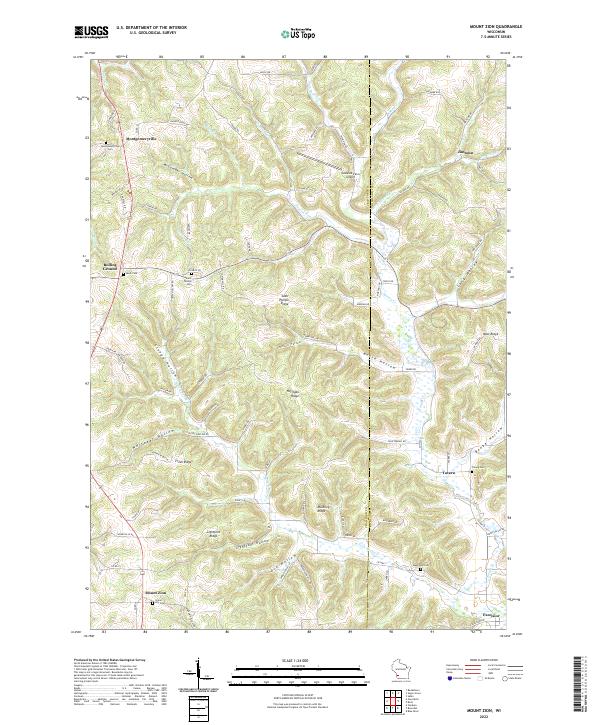
2022 Map of Mount Zion
USGS Topo · Published 2022About this map
The ridge-and-valley landscape of the Driftless Area is clearly defined on this map of Mount Zion and the surrounding border of Crawford and Richland counties. The settlement pattern follows the high ground of Saint Phillips Ridge and Horrigan Ridge, while the deep drainage basins of Knapp Cr and its tributaries, such as English Run and Pigeon Run, create a complex network of hollows including Welsh Hollow and McCumber Hollow. This topography heavily influenced the placement of rural centers like Montgomeryville and Rolling Ground. For genealogists, the map is particularly valuable for its documentation of numerous upland burial grounds, including the Montgomeryville Cem, Tavera Cem, and Union Hill Cem, often located at the edges of ridges or near country crossroads. The presence of the Leeward Farm Airport and a dense network of county roads like Co Hwy U illustrates the modern transport connectivity imposed upon this complex, unglaciated terrain.
Find a feature on this map
97 named features on this map. Tap any name to fly to it.
Don’t see what you’re looking for? This feature index may not catch every label — zoom into the map to look around manually.
Map Details
Editions of this 2022 Mount Zion Map
This is the sole edition of this map. No revisions or reprints were ever made.
Other maps of this area

1924 · Gays Mills
USGS Topo · 1:62,500

1926 · Gays Mills
USGS Topo · 1:62,500

1926 · Wauzeka
USGS Topo · 1:62,500

1933 · Boaz
USGS Topo · 1:62,500

1933 · Boscobel
USGS Topo · 1:62,500

1958 · La Crosse
USGS Topo · 1:250,000

1961 · La Crosse
USGS Topo · 1:250,000

1965 · La Crosse
USGS Topo · 1:250,000
1966 · Gays Mills
USGS Topo · 1:62,500

1966 · Boaz
USGS Topo · 1:62,500