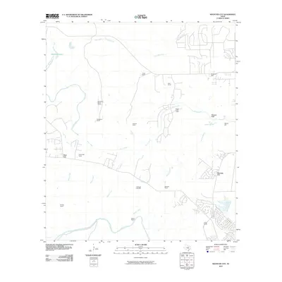
2010 Map of Mountain City
USGS Topo · Published 2010About this map
Mountain City and the surrounding Hill Country landscape appear in this 2010 survey, characterized by large ranching estates and meandering riparian corridors. The southern boundary is defined by the winding Blanco River, while the central terrain is drained by several waterways including Onion Creek, Plum Creek, and Mustang Branch. This area is notable for its numerous named properties such as Gregg Ranch, Hoskins Ranch, and Farris Ranch, reflecting a legacy of private land ownership and pastoral development. Landmarks like Flatrock Ford and Barber Falls highlight the natural geology of the creek beds. Aviation and community infrastructure are visible through the Rutherford Ranch Airport and Onion Creek Lodge, while the small settlement of Hays City sits in the western portion of the quadrangle. The map captures the transition of these rural landscapes into more developed residential pockets like Carpenter Hills.
Find a feature on this map
29 named features on this map. Tap any name to fly to it.
Don’t see what you’re looking for? This feature index may not catch every label — zoom into the map to look around manually.
Map Details
Editions of this 2010 Mountain City Map
This is the sole edition of this map. No revisions or reprints were ever made.
Other maps of this area

1887 · Blanco
USGS Topo · 1:125,000

1894 · Blanco
USGS Topo · 1:125,000

1896 · Austin
USGS Topo · 1:125,000

1897 · Austin
USGS Topo · 1:125,000

1910 · Austin
USGS Topo · 1:125,000

1911 · San Marcos
USGS Topo · 1:125,000

1919 · San Marcos
USGS Topo · 1:125,000

1929 · Hunter
USGS Topo · 1:62,500

1953 · Seguin
USGS Topo · 1:250,000

1954 · Llano
USGS Topo · 1:250,000