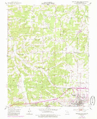
1951 Map of Mountain Grove North
USGS Topo · Published 1985About this map
Mountain Grove serves as the focal point for this Missouri survey, which illustrates a landscape defined by the intersection of small-scale agriculture and early scientific research. The town's periphery is marked by the State Experiment Station, highlighting the region's historical commitment to agricultural development. The terrain is divided by the Dove Mountains and a network of waterways including Whetstone Creek and Beaver Creek.
Find a feature on this map
37 named features on this map. Tap any name to fly to it.
Don’t see what you’re looking for? This feature index may not catch every label — zoom into the map to look around manually.
Map Details
Editions of this 1951 Mountain Grove North Map
2 editions found
Other maps of this area

1931 · Manes
USGS Topo · 1:48,000

1941 · Manes
USGS Topo · 1:62,500

1941 · Bado
USGS Topo · 1:62,500

1943 · Manes
USGS Topo · 1:62,500

1943 · Bado
USGS Topo · 1:62,500

1950 · Cabool SW
USGS Topo · 1:24,000

1951 · Norwood
USGS Topo · 1:24,000

1951 · Mountain Grove South
USGS Topo · 1:24,000

1951 · Mountain Grove North
USGS Topo · 1:24,000

1951 · Cabool NW
USGS Topo · 1:24,000