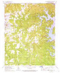
1966 Map of Mountain Home East
USGS Topo · Published 1967About this map
Mountain Home serves as the focal point of this mid-1960s Baxter County survey, situated just west of the extensive waters of Norfork Lake. The map reveals a landscape defined by sharp elevation changes, from the high ground of Heart Bald and the Buckhorn region to the deep drainages of Hicks Creek and Big Creek. This era shows the developed recreation along the lake's winding shoreline, including Buzzard Roost Landing and Traceys Landing. Local family history is preserved through a high density of burial grounds and rural institutions, such as Old Oakland Cem, Douglas Cem, and the Oak Grove Ch. The presence of several Quarry and Gravel Pit sites near the settlement suggests the active local industry and infrastructure development of the period.
Find a feature on this map
33 named features on this map. Tap any name to fly to it.
Don’t see what you’re looking for? This feature index may not catch every label — zoom into the map to look around manually.
Map Details
Editions of this 1966 Mountain Home East Map
2 editions found
Other maps of this area

1890 · Mountain Home
USGS Topo · 1:125,000

1891 · Mountain Home
USGS Topo · 1:125,000

1894 · Mountain Home
USGS Topo · 1:125,000

1945 · Harrison
USGS Topo · 1:250,000

1949 · Harrison
USGS Topo · 1:250,000

1954 · Harrison
USGS Topo · 1:250,000

1958 · Harrison
USGS Topo · 1:250,000

1964 · Harrison
USGS Topo · 1:250,000
1964 · Norfork Dam South
USGS Topo · 1:24,000
1965 · Clarkridge
USGS Topo · 1:24,000