Loading...
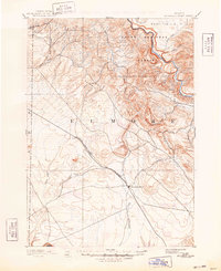
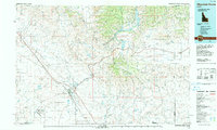
Loading map...1893 Map of Mountain Home
USGS Topo · Published 1948About this map
Mountain Home serves as the central hub of this late 19th-century landscape, situated along the vital transport artery of the Oregon Short Line Railroad. This reconnaissance-style mapping captures the high desert and rugged canyonlands of Elmore County as they appeared just years after the railroad's arrival transformed the region's economy. To the north, the Boise River carves through the terrain, with the Boise National Forest and Smith Prairie defining the northern reaches of the quadrangle.
Find a feature on this map
22 named features on this map. Tap any name to fly to it.
Don’t see what you’re looking for? This feature index may not catch every label — zoom into the map to look around manually.
Map Details
Date Portrayed1893
Date Published1948
PublisherU.S. Geological Survey
Map TypeTopographic
Scale1:125,000
Physical Dimensions17 x 20.8 inches
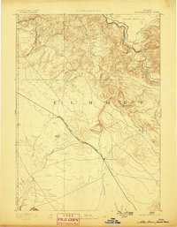
Editions of this 1893 Mountain Home Map
4 editions found

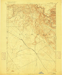
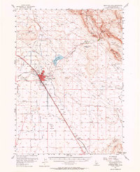
Historical Maps of Mountain Home Through Time
4 maps found

Featured Locations
Source Details
SourceU.S. Geological Survey
CopyrightPublic Domain