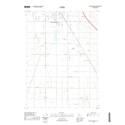
2020 Map of Mountain Home South
USGS Topo · Published 2020About this map
Mountain Home serves as the focal point for this Idaho landscape, where the transition from urban streets to structured agricultural tracts is evident in the 2020 layout. The town's grid gives way to a sprawling network of rural roads such as Smith Rd and Old Grandview Rd, reflecting the region's long-standing reliance on irrigation and aviation. The E Side Canal cuts through the terrain, supporting the agricultural vitality of areas like Slade Flat and the small community at Clover Hollow. For those interested in regional infrastructure, the presence of the Coyote Run Airport and the historic path of Old Hwy 30 illustrates how transportation corridors have shaped Elmore County over the decades. The map provides a precise look at the modern land use patterns, from residential developments to the open basins that define the high desert plains south of the city.
Find a feature on this map
60 named features on this map. Tap any name to fly to it.
Don’t see what you’re looking for? This feature index may not catch every label — zoom into the map to look around manually.
Map Details
Editions of this 2020 Mountain Home South Map
This is the sole edition of this map. No revisions or reprints were ever made.
Other maps of this area

1892 · Mountain Home
USGS Topo · 1:125,000

1893 · Mountain Home
USGS Topo · 1:125,000

1947 · Bruneau
USGS Topo · 1:62,500

1947 · Indian Cove
USGS Topo · 1:24,000

1947 · Sand Dunes
USGS Topo · 1:24,000

1947 · Bruneau
USGS Topo · 1:24,000

1948 · Sand Dunes
USGS Topo · 1:24,000

1948 · Indian Cove
USGS Topo · 1:24,000
1948 · Bruneau
USGS Topo · 1:24,000

1948 · Indian Cove
USGS Topo · 1:62,500