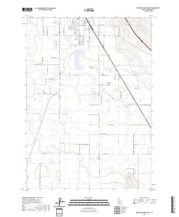
2023 Map of Mountain Home South
USGS Topo · Published 2023About this map
Coyote Run Airport sits at the heart of this high-desert landscape south of Mountain Home, where irrigation infrastructure dictates the patterns of settlement. The East Side Canal and West Side Canal cut through the terrain, supporting local agriculture across Slade Flat and the depressions of Clover Hollow. The road network reflects a shift from historical thoroughfares like Old Grandview Rd and S Main St to modern residential developments such as Sw Silverstone Ave and Se Sunrise Dr. Family names and local history are preserved in the naming of rural routes like Daniels Rd, Lemmon Ln, and Sw Torres Pedroza Dr, marking the transition from open range to a more structured grid of townships and ranges.
Find a feature on this map
59 named features on this map. Tap any name to fly to it.
Don’t see what you’re looking for? This feature index may not catch every label — zoom into the map to look around manually.
Map Details
Editions of this 2023 Mountain Home South Map
This is the sole edition of this map. No revisions or reprints were ever made.
Other maps of this area

1892 · Mountain Home
USGS Topo · 1:125,000

1893 · Mountain Home
USGS Topo · 1:125,000

1947 · Bruneau
USGS Topo · 1:62,500

1947 · Indian Cove
USGS Topo · 1:24,000

1947 · Sand Dunes
USGS Topo · 1:24,000

1947 · Bruneau
USGS Topo · 1:24,000

1948 · Sand Dunes
USGS Topo · 1:24,000

1948 · Indian Cove
USGS Topo · 1:24,000
1948 · Bruneau
USGS Topo · 1:24,000

1948 · Indian Cove
USGS Topo · 1:62,500