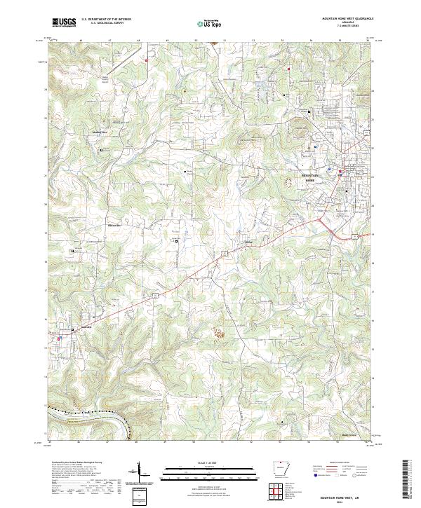
2024 Map of Mountain Home West
USGS Topo · Published 2024About this map
Mountain Home serves as the regional anchor on this contemporary survey of Baxter County, centered on the Baxter County Courthouse and the growing campus of Arkansas State University - Mountain Home. The landscape transitions from the urbanized streets of the county seat toward the rural west, where smaller settlements like Gassville and Whiteville maintain their distinct identities along the highway corridors. The topography is defined by the winding course of the White River along the southern boundary and local high points such as Capitol Hill and Monkey Run Hill.
Find a feature on this map
46 named features on this map. Tap any name to fly to it.
Don’t see what you’re looking for? This feature index may not catch every label — zoom into the map to look around manually.
Map Details
Editions of this 2024 Mountain Home West Map
This is the sole edition of this map. No revisions or reprints were ever made.
Other maps of this area

1890 · Mountain Home
USGS Topo · 1:125,000

1891 · Mountain Home
USGS Topo · 1:125,000

1893 · Yellville
USGS Topo · 1:125,000

1894 · Mountain Home
USGS Topo · 1:125,000

1903 · Yellville
USGS Topo · 1:125,000

1905 · Yellville
USGS Topo · 1:125,000

1929 · Yellville
USGS Topo · 1:125,000

1945 · Harrison
USGS Topo · 1:250,000

1949 · Harrison
USGS Topo · 1:250,000

1954 · Harrison
USGS Topo · 1:250,000