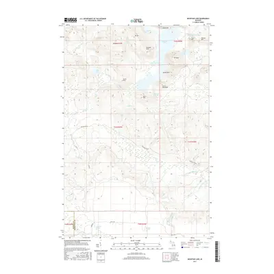
2017 Map of Mountain Lake
USGS Topo · Published 2017About this map
Huron Mountains peaks dominate this high-relief terrain along the border of Baraga and Marquette counties. The landscape is defined by significant elevation changes, with named heights including Mt Benison, Mt Ida, and Tokiahok Head rising above a complex network of freshwater basins. Mountain Lake is the central feature, featuring the distinctive Lumberman Bay and Dudley Point. The area's hydrology is particularly active, marked by the presence of Turkey Neck Falls and Forty Foot Falls along the Cliff River. To the south, the terrain levels into the Bentley Ponds area, while the Salmon Trout River and its W Br Salmon Trout River drain the eastern slopes. A sparse road network, including Northwestern RD and Triple A RD, provides the only modern access through these steep ridges and secluded valleys, illustrating the preserved wilderness character of this Upper Peninsula interior.
Find a feature on this map
41 named features on this map. Tap any name to fly to it.
Don’t see what you’re looking for? This feature index may not catch every label — zoom into the map to look around manually.
Map Details
Editions of this 2017 Mountain Lake Map
This is the sole edition of this map. No revisions or reprints were ever made.
Other maps of this area

1954 · Huron Mountain
USGS Topo · 1:62,500

1954 · Skanee
USGS Topo · 1:62,500

1955 · Champion
USGS Topo · 1:62,500

1956 · Michigamme
USGS Topo · 1:62,500

1958 · Marquette
USGS Topo · 1:250,000

1958 · Iron River
USGS Topo · 1:250,000

1960 · Iron River
USGS Topo · 1:250,000

1960 · Marquette
USGS Topo · 1:250,000

1961 · Marquette
USGS Topo · 1:250,000

1961 · Iron River
USGS Topo · 1:250,000