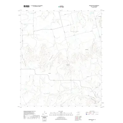
2019 Map of Mountain Pass
USGS Topo · Published 2019About this map
Mountain Pass sits at the heart of this Taylor County landscape, where the high mesas of the Callahan Divide break into a series of deep canyons and prominent peaks. The terrain is defined by dramatic elevation changes, notably at Bald Mtn and Castle Peak, which overlook the expansive Mulberry Canyon to the north. Water is a scarce but defining element in this semi-arid region, marked by the presence of Butman Falls and the drainage of Elm Cr.
Find a feature on this map
35 named features on this map. Tap any name to fly to it.
Don’t see what you’re looking for? This feature index may not catch every label — zoom into the map to look around manually.
Map Details
Editions of this 2019 Mountain Pass Map
This is the sole edition of this map. No revisions or reprints were ever made.
Other maps of this area

1890 · Abilene
USGS Topo · 1:125,000

1892 · Abilene
USGS Topo · 1:125,000

1893 · Sweetwater
USGS Topo · 1:125,000

1954 · Big Spring
USGS Topo · 1:250,000

1954 · Abilene
USGS Topo · 1:250,000

1957 · Merkel
USGS Topo · 1:62,500

1957 · Buffalo Gap
USGS Topo · 1:62,500

1958 · Big Spring
USGS Topo · 1:250,000

1958 · Abilene
USGS Topo · 1:250,000
1967 · Shep
USGS Topo · 1:24,000