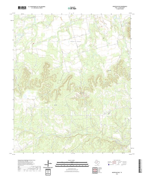
2022 Map of Mountain Pass
USGS Topo · Published 2022About this map
Mulberry Canyon dominates the northern landscape of this Taylor County terrain, where the undulating peaks of the Callahan Divide transition into deep drainage basins. The area is defined by a series of prominent topographical landmarks including Castle Peak, Riney Peak, and Bald Mtn, which overlook the complex network of draws and hollows such as Mapes Hollow and Horse Hollow. Water resources are central to the local geography, featuring the Billy Doan Reservoir and Hugh Lilly Lake, along with the seasonal flows of Mulberry Cr and Elm Cr. Genealogy researchers will find the Dudley Cem situated in the southeastern portion of the quadrangle near the junction of Co RD 618 and FM 89. The map also traces the historic alignment of the Butterfield Trail Rd, providing a tangible link to 19th-century western migration and transportation routes that once traversed this rugged portion of the Texas frontier.
Find a feature on this map
36 named features on this map. Tap any name to fly to it.
Don’t see what you’re looking for? This feature index may not catch every label — zoom into the map to look around manually.
Map Details
Editions of this 2022 Mountain Pass Map
This is the sole edition of this map. No revisions or reprints were ever made.
Other maps of this area

1890 · Abilene
USGS Topo · 1:125,000

1892 · Abilene
USGS Topo · 1:125,000

1893 · Sweetwater
USGS Topo · 1:125,000

1954 · Big Spring
USGS Topo · 1:250,000

1954 · Abilene
USGS Topo · 1:250,000

1957 · Merkel
USGS Topo · 1:62,500

1957 · Buffalo Gap
USGS Topo · 1:62,500

1958 · Big Spring
USGS Topo · 1:250,000

1958 · Abilene
USGS Topo · 1:250,000
1967 · Shep
USGS Topo · 1:24,000