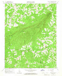
1965 Map of Mountain Valley
USGS Topo · Published 1967About this map
Turkeycock Mountain dominates this landscape along the borders of Henry, Franklin, and Pittsylvania counties in the mid-1960s. The map illustrates a rural Piedmont community organized around local landmarks such as Mountain Valley and the smaller crossroads of Vashti. Significant local industry and commerce of earlier eras are preserved in the labels for Swansons Mill, Hodges Mill, Giles Store, and Parkers Store.
Find a feature on this map
46 named features on this map. Tap any name to fly to it.
Don’t see what you’re looking for? This feature index may not catch every label — zoom into the map to look around manually.
Map Details
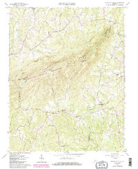
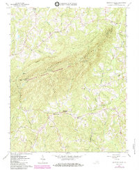
Editions of this 1965 Mountain Valley Map
3 editions found
Other maps of this area

1922 · Callands
USGS Topo · 1:48,000

1924 · Martinsville
USGS Topo · 1:48,000

1924 · Draper
USGS Topo · 1:48,000

1924 · Callands
USGS Topo · 1:62,500

1925 · Rocky Mount
USGS Topo · 1:48,000

1926 · Martinsville
USGS Topo · 1:62,500

1926 · Draper
USGS Topo · 1:62,500

1927 · Rocky Mount
USGS Topo · 1:62,500

1927 · Martinsville
USGS Topo · 1:62,500

1944 · Martinsville
USGS Topo · 1:62,500