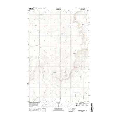
2014 Map of Mountain View School
USGS Topo · Published 2014About this map
Mountain View School stands as a lone educational landmark in this stretch of Toole County, where the high plains are carved by drainage systems like Healy Coulee and Rocky Springs Coulee. The landscape's industrial character is defined by the Kevin Sunburst Oil Field in the southeastern quadrant, illustrating the region's long-standing reliance on energy extraction. This area is punctuated by numerous seasonal and permanent water bodies, including Benton Trail Lakes, Frenchman Lake, and the curiously named Cowboys Lake. A rigid grid of section lines and gravel tracks such as Rim Rd and Enneberg Rd provides the primary framework for movement through this sparse, ranching and resource-heavy territory.
Find a feature on this map
24 named features on this map. Tap any name to fly to it.
Don’t see what you’re looking for? This feature index may not catch every label — zoom into the map to look around manually.
Map Details
Editions of this 2014 Mountain View School Map
This is the sole edition of this map. No revisions or reprints were ever made.
Other maps of this area

1909 · Cut Bank
USGS Topo · 1:125,000

1912 · Cut Bank
USGS Topo · 1:125,000

1939 · Sunburst
USGS Topo · 1:62,500

1943 · Shelby
USGS Topo · 1:62,500

1954 · Shelby
USGS Topo · 1:250,000

1958 · Shelby
USGS Topo · 1:250,000

1960 · Cut Bank
USGS Topo · 1:250,000

1963 · Cut Bank
USGS Topo · 1:250,000

1964 · Cut Bank
USGS Topo · 1:250,000

1966 · Ethridge NW
USGS Topo · 1:24,000