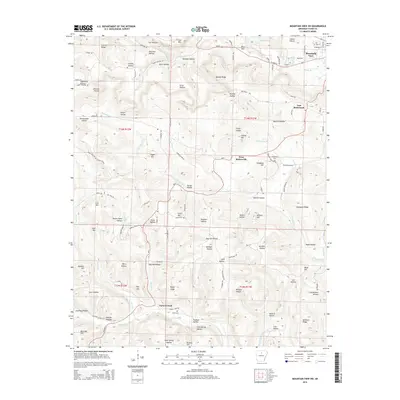
2014 Map of Mountain View SW
USGS Topo · Published 2014About this map
Mountain View sits at the northeastern corner of this 2014 survey, serving as a gateway to the high ridges and deep hollows of Stone County. The landscape is defined by its complex topography, where heights like Indian Knob and Cow Mtn rise above a dense network of watercourses including Tomahawk Cr and Lick Fork. Settlement patterns follow the valley floors and lower ridges, most notably at East Richwoods and West Richwoods.
Find a feature on this map
122 named features on this map. Tap any name to fly to it.
Don’t see what you’re looking for? This feature index may not catch every label — zoom into the map to look around manually.
Map Details
Editions of this 2014 Mountain View SW Map
This is the sole edition of this map. No revisions or reprints were ever made.
Other maps of this area

1892 · Mountain View
USGS Topo · 1:125,000

1894 · Mountain View
USGS Topo · 1:125,000

1956 · Russellville
USGS Topo · 1:250,000

1964 · Russellville
USGS Topo · 1:250,000
1964 · Sylamore
USGS Topo · 1:24,000

1969 · Mountain View SW
USGS Topo · 1:24,000
1969 · Fox
USGS Topo · 1:24,000
1969 · Mountain View
USGS Topo · 1:24,000
1972 · Onia
USGS Topo · 1:24,000
1972 · Fiftysix
USGS Topo · 1:24,000