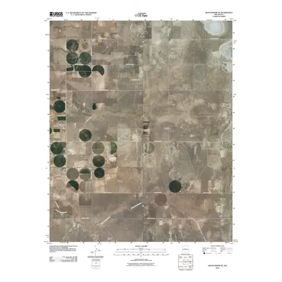
2010 Map of Mountainair NE
USGS Topo · Published 2010About this map
Estancia Cemetery serves as a prominent landmark on this high plains landscape of Torrance County, situated near the northern boundary of the map. The area's agricultural and ranching heritage is clearly visible through family-named sites such as Spruill Ranch and Moe Ranch, along with the critical water infrastructure of the Berkshire Windmill. The terrain is shaped by ephemeral watercourses, most notably the winding Arroyo de Manzano and Torreon Draw, which dictate the placement of ranch buildings and local roads. A rigid grid of county thoroughfares, including Spencer Rd and Blackfoot Rd, underscores the systematic land division of this New Mexico territory. This 2010 survey illustrates the persistence of rural ranching life in the region, where wide-open spaces are punctuated only by scattered homesteads and the vital connectivity of maintained county roads.
Find a feature on this map
25 named features on this map. Tap any name to fly to it.
Don’t see what you’re looking for? This feature index may not catch every label — zoom into the map to look around manually.
Map Details
Editions of this 2010 Mountainair NE Map
This is the sole edition of this map. No revisions or reprints were ever made.
Other maps of this area

1917 · Estancia
USGS Topo · 1:125,000

1954 · Milbourn Ranch
USGS Topo · 1:24,000

1954 · Fort Sumner
USGS Topo · 1:250,000

1954 · Socorro
USGS Topo · 1:250,000

1956 · Estancia
USGS Topo · 1:62,500

1956 · Mountainair
USGS Topo · 1:62,500

1958 · Socorro
USGS Topo · 1:250,000

1958 · Fort Sumner
USGS Topo · 1:250,000

1960 · Lobo Hill
USGS Topo · 1:62,500

1962 · Socorro
USGS Topo · 1:250,000